Asura International Seminar
Wednesday February 10th 13:30-, 2016.
2016年2月10日(水)
Seminar room (BF1) of Wildlife Research Center
WRCセミナー室


Talk
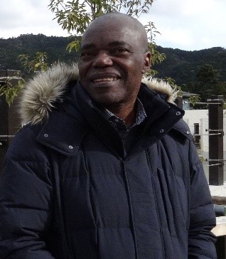
Prof. Raymond S. Lumbuenamo

Title: Monitoring Forest cover change to assist conservation efforts in the Democratic Republic of the Congo
Abstract:
The changes in forest cover has become a matter of global concern as forests play a vital role in carbon recycling, maintaining the environmental setup, and the ecological integrity of systems on which the entire planet depends. This is even more so in the DRCongo where not only more than half the population is almost exclusively dependent on the forest for their livelihoods but also because, over 85% of the rains that fall over the Congo Basin is dependent on the forest.
In this part of the world, worrying signs of big catastrophes to come are becoming tangible by the day. It has thus become imperative that information be made available to the decision makers at all levels to raise their awareness and prompt them into action in order to prevent the looming crisis from erupting.
Remote sensing coupled with GIS (Geographical Information System) is a potential tool, for monitoring the changes in land cover, identifying the conservation priorities in global hotspots, rating deforestation and quantifying overall forest cover loss at finer scale. Remote sensing and GIS can help generate an integrated Decision Support System (DSS) to assist tropical forest researchers in making informed decisions and enable policy makers/managers to better understand the linkages between local, regional and global processes, take effective management decisions and achieve the goal of sustainable development of biodiversity in tropical and subtropical countries.
During this talk, I will explain how we, on a very modest scale, are trying to use this tool to inform conservation efforts, land use and land management in the DRC
参加者数:20人